EastWest Mapping Lugnaquillla & Glendalough Waterproof Map (Laminated)(1:25,000)
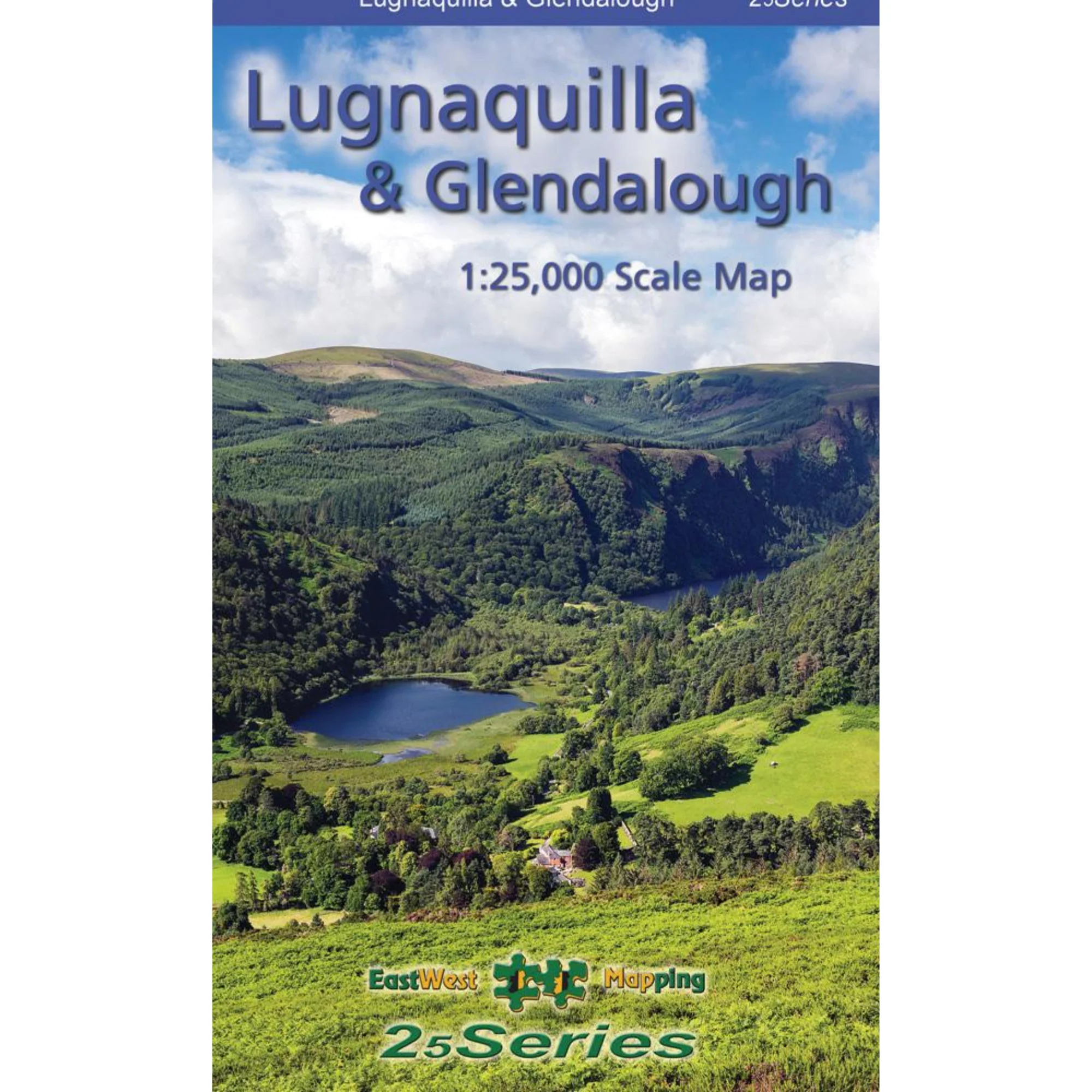
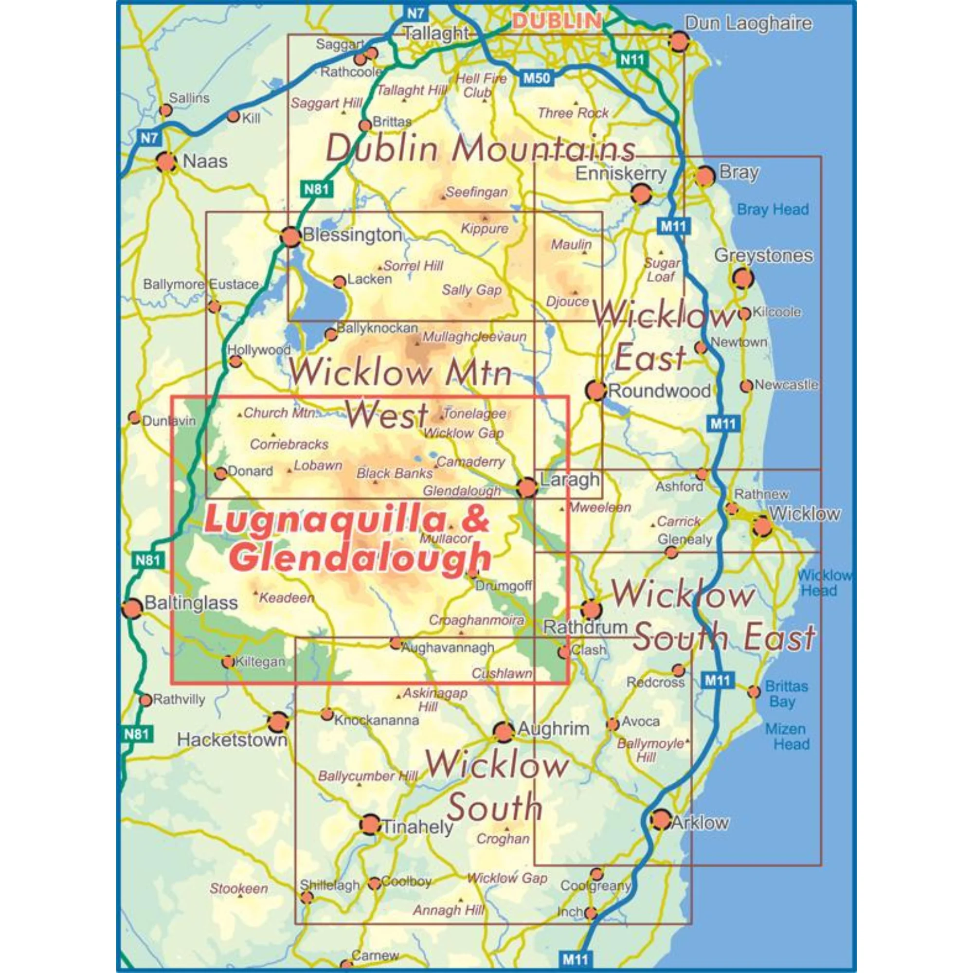
Definitive detailed map from EastWest Mapping's 25Series of Wicklow at 1:25,000 scale covering from Wicklow Gap to Aughavannagh and Donard to Laragh.
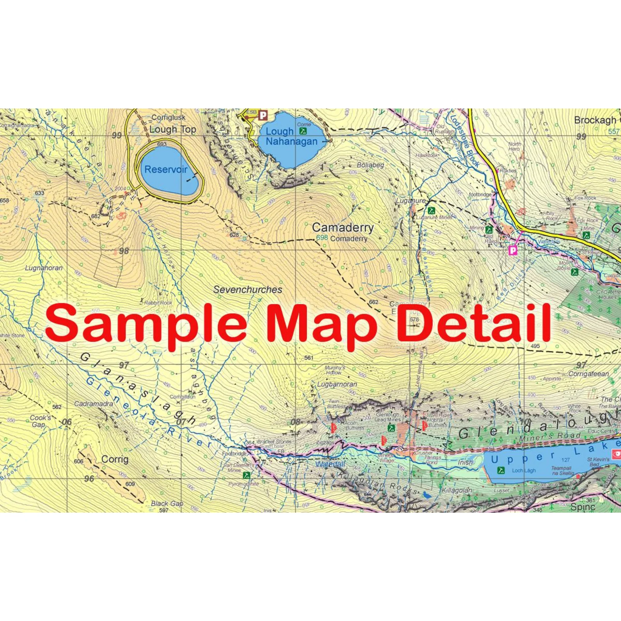
Districts of Glendalough, Glenmalure, Lugnaquilla, Wicklow Gap and Imaal all shown. Depicts in very considerable detail some of the most scenic parts of Wicklow for the benefit of both visitor and local alike. EastWest Mapping have conducted considerable research into local sites & placenames and much information is recorded on this map.
Printed on good quality Progeo 90gsm map paper. The map sheet measures 1125mm x 820mm, covering 550sq kilometres and is folded down to 125mm x 205mm.
- Paper quality: Progeo 90gsm map paper
- Open dimensions: 112.5cm x 82cm
- Folded dimensions: 12.cm x 20.5cm
- Published: April 2018
- Fully encapsulated/laminated for durability and weatherproofing.
- Scale: 1:25,000
- Contour Interval: 5 metres
1:25,000 Scale : 1 centimetre on the map = 250 metres on the ground.
Why not check out our waterproof map cases and dry bags to keep your valuables safe on the mountains!
Check out EastWest Mapping's FAQ section for Care Instructions and Key to Symbols
EastWest Mapping Lugnaquillla & Glendalough Waterproof Laminated Map 1:25,000 EWLGGL-WP
Original: $28.11
-65%$28.11
$9.84More Images
EastWest Mapping Lugnaquillla & Glendalough Waterproof Map (Laminated)(1:25,000)
Definitive detailed map from EastWest Mapping's 25Series of Wicklow at 1:25,000 scale covering from Wicklow Gap to Aughavannagh and Donard to Laragh.
Districts of Glendalough, Glenmalure, Lugnaquilla, Wicklow Gap and Imaal all shown. Depicts in very considerable detail some of the most scenic parts of Wicklow for the benefit of both visitor and local alike. EastWest Mapping have conducted considerable research into local sites & placenames and much information is recorded on this map.
Printed on good quality Progeo 90gsm map paper. The map sheet measures 1125mm x 820mm, covering 550sq kilometres and is folded down to 125mm x 205mm.
- Paper quality: Progeo 90gsm map paper
- Open dimensions: 112.5cm x 82cm
- Folded dimensions: 12.cm x 20.5cm
- Published: April 2018
- Fully encapsulated/laminated for durability and weatherproofing.
- Scale: 1:25,000
- Contour Interval: 5 metres
1:25,000 Scale : 1 centimetre on the map = 250 metres on the ground.
Why not check out our waterproof map cases and dry bags to keep your valuables safe on the mountains!
Check out EastWest Mapping's FAQ section for Care Instructions and Key to Symbols
EastWest Mapping Lugnaquillla & Glendalough Waterproof Laminated Map 1:25,000 EWLGGL-WP
Product Information
Product Information
Shipping & Returns
Shipping & Returns
Description
Definitive detailed map from EastWest Mapping's 25Series of Wicklow at 1:25,000 scale covering from Wicklow Gap to Aughavannagh and Donard to Laragh.
Districts of Glendalough, Glenmalure, Lugnaquilla, Wicklow Gap and Imaal all shown. Depicts in very considerable detail some of the most scenic parts of Wicklow for the benefit of both visitor and local alike. EastWest Mapping have conducted considerable research into local sites & placenames and much information is recorded on this map.
Printed on good quality Progeo 90gsm map paper. The map sheet measures 1125mm x 820mm, covering 550sq kilometres and is folded down to 125mm x 205mm.
- Paper quality: Progeo 90gsm map paper
- Open dimensions: 112.5cm x 82cm
- Folded dimensions: 12.cm x 20.5cm
- Published: April 2018
- Fully encapsulated/laminated for durability and weatherproofing.
- Scale: 1:25,000
- Contour Interval: 5 metres
1:25,000 Scale : 1 centimetre on the map = 250 metres on the ground.
Why not check out our waterproof map cases and dry bags to keep your valuables safe on the mountains!
Check out EastWest Mapping's FAQ section for Care Instructions and Key to Symbols
EastWest Mapping Lugnaquillla & Glendalough Waterproof Laminated Map 1:25,000 EWLGGL-WP